
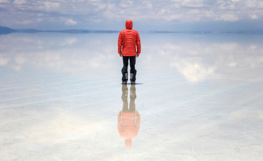
Wait for the rain to stop and the wind to drop, and about ten thousand square kilometres of Bolivia quietly stops being ground and starts being sky.
Salar de Uyuni sits at roughly 3,650 metres on the Altiplano, a high plain in the central Andes with no drainage outlet. Between December and April a shallow film of water settles on the salt crust and reflects everything above it, horizon to horizon. Tourists arrive in convoys for the photographs. Geodesists arrive for reasons that are much less romantic and, frankly, stranger.
Why the salt is so flat
The European Space Agency puts the variation in surface elevation across the entire salar at under one metre. For a feature the size of a small country, that is close to absurd. It got that way slowly: a giant prehistoric lake covered the basin around 40,000 years ago and dried out, leaving a thick crust of halite, which is ordinary table salt.
Age alone levels nothing, though. Weather usually makes terrain messier over time, not tidier. What keeps Uyuni smooth is the flooding itself. Rain dissolves salt off the high spots, carries it in solution to the low spots and drops it there when the water evaporates again. The surface resurfaces itself every summer, a bit like a skating rink getting a fresh pass from the Zamboni.
Measuring a place with almost nothing to measure
In September 2002, two vehicles with choke ring GPS antennas bolted to their roofs spent six days driving grid patterns across the eastern lobe at an average of 120 kilometres an hour. Adrian Borsa and colleagues, writing in Geophysical Journal International, turned that into an elevation model of a 45 by 54 kilometre patch, accurate to within about 2.2 centimetres.
Across 50 kilometres of salt, the ground rose and fell by a grand total of 77 centimetres.
More than half of that came from the planet itself rather than from the terrain. Earth’s gravity field is lumpy, and the surface it defines, called the geoid, bulges and sags by tens of metres worldwide. Because the salar is levelled by water that settles along that surface, the salt has slowly taken its shape. Strip the geoid model out of the data and the remaining range drops to 44 centimetres. Borsa’s team found the leftover bumps lined up with local gravity measurements, including a rise near a rocky island thought to be a buried volcanic peak.
None of this shows up in conventional mapping. Shuttle Radar Topography Mission data, the best public elevation set for the region, showed roughly 15 metres of apparent relief over the same ground. Essentially all of it was error.
What anyone wants a flat surface for
Satellite altimeters work out height by timing a pulse to the ground and back. To trust the number, you need a target whose height you already know independently, and you need it to be big, boring and unchanging.
Salt flats fit because they are broad, stable and about as reflective as ice, which matters when the satellite in question was built to watch the polar caps. NASA’s ICESat mission used Uyuni as its reference. Helen Fricker and colleagues, reporting in Geophysical Research Letters, found that under clear skies and nominal laser power the spacecraft’s elevations over the salar landed within 2 centimetres of truth, with scatter under 3. That was the whole point: the mission needed to detect changes as small as a centimetre and a half per year, and something on the ground had to prove it could.
Europe leans on the same patch of salt. ESA describes it as ideal for calibrating radar altimeters, the class of instrument flown on CryoSat and Sentinel-3.
The mirror gets in the way
All of which sets up a small irony. When the flat becomes a mirror, it stops being useful.
Fricker’s team recorded two ICESat passes in March 2005 while the salar was under water. Tiny ripples angled square to the beam bounced the laser back with enormous energy, saturating the detector and mangling the returned waveform. The resulting elevations were off by around a metre, on a surface known to a couple of centimetres.
Optical sensors have the same trouble. Uyuni is one of a handful of sites worldwide, alongside deserts in Algeria and Nevada and stretches of Antarctic ice, used to confirm satellite cameras are reading brightness accurately. Gemma Tarlach, reporting for Atlas Obscura in 2022, described months of freak rainfall turning the expanse into swirls of sediment, wind-drawn ridges and algal colour. Gorgeous, and worthless as a blank reference card.
The brine underneath
Below the crust sits blue-green brine thick with lithium. NASA’s Earth Observatory notes geologists rank the deposit among the world’s biggest, while Bolivia has never broken into the top tier of producers. Landsat first picked up evaporation ponds at the southern edge in 2011, and the facility has expanded a good deal since. Extraction is awkward there: the brine carries high concentrations of magnesium and potassium that have to be stripped out, and the climate is cool and damp enough that evaporation runs slower than at competing operations in Chile and Argentina.
Which leaves the salar doing two jobs that pull against each other. Pumped brine and standing floodwater draw from the same near-surface layer of salt, and the annual flood is the only known mechanism holding that surface to within a metre of level. What that balance looks like after decades of industrial draw is something nobody has measured yet.