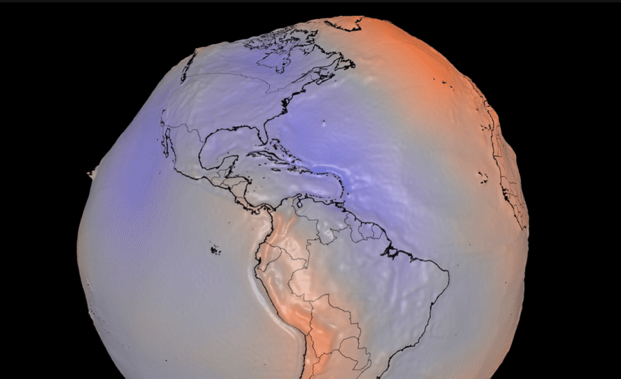
a new visualisation of Earth looks nothing like the Blue Marble seen from space.
Nasa has released a new geoid model showing the shape of Earth’s gravitational field. The slight, irregular bulges and depressions are caused by variations in the distribution of mass within the planet. It can also be imagined as the surface a global ocean would take if it were determined solely by Earth’s own gravity and rotation.
Science advisor: Scott Luthcke (NASA/GSFC) Visualizer: Mark SubbaRao (NASA/GSFC)
The visualisation is an exaggerated geoid, with heights multiplied by a factor of 10,000 in order to show the variations in the gravitational field. Nasa created this lumpy version of Earth using models and data from satellites, which can detect minute differences in gravity at different locations. The dataset stretches back 15 years and includes a billion observations. Nasa also shared an interactive 3D model of the geoid that you can explore here as well as a longer video.
Measuring gravity has value beyond creating jarring visuals that’ll make you question just how round Earth is. Nasa and the European Space Agency both have satellites that keep tabs on the planet’s gravitational field.
These observations have been used to get a better handle on how much ice Antarctica and Greenland are losing as the planet warms. Nasa’s satellites – which operate as part of the Gravity Recovery and Climate Experiment (GRACE) – show that Antarctica has lost approximately 135 gigatons of ice per year between 2002 and 2025, while Greenland has lost 264 gigatons of ice annually over that same period. Improving those estimates is key to understanding how much oceans are rising now – and how much more they’ll rise in the future.